
NPMCA field guide · Public tools and downloads
Estimate Pavement Area from Satellite Images, Then Verify the Job
Use a satellite image to screen a job and measure its visible footprint, then check the pavement on site before making a firm promise. Keep a dated sketch and record what the image cannot show.
Author: NPMCA · Updated · Version 1
Sources are checked; this is general education, not professional advice.
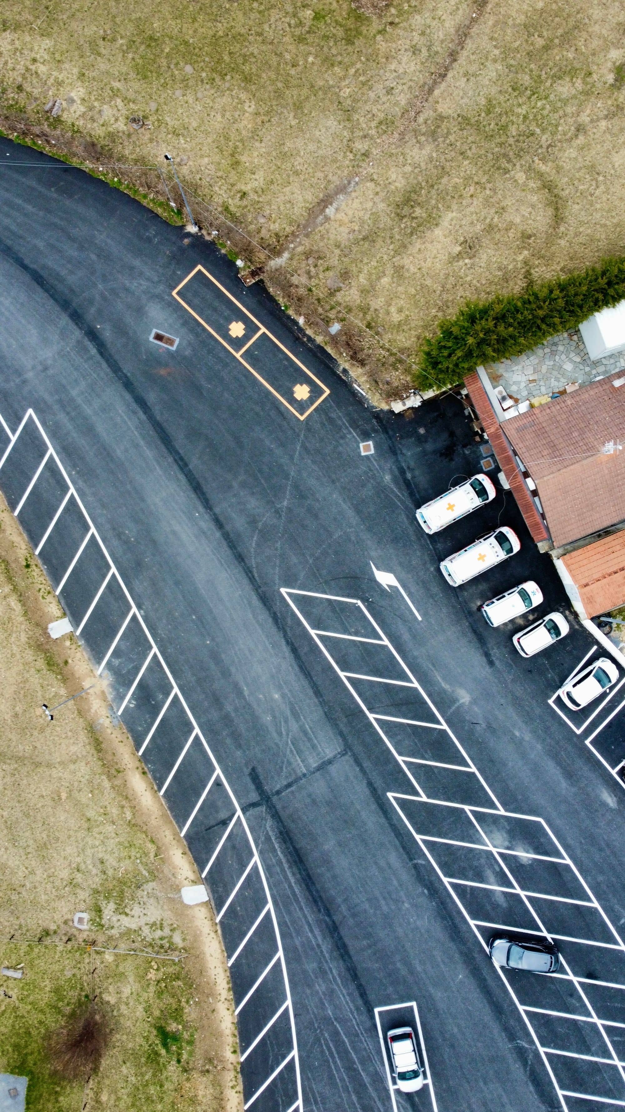
Photo: Jack Taggiasco / Pexels, Pexels License
Before you start
- The customer's site and permission to inspect.
- A map tool whose imagery, attribution and export terms you have checked, or a manual drawing.
- A wheel or tape and safe access for field verification.
What you will finish with
- A visible-footprint takeoff with deductions and source date.
- A provisional scope with unresolved checks.
- A confirmed field measurement version ready for the materials calculator and bid.
Source note: sources below were checked as of October 11, 2026. Product revisions, local rules and your written quotes control the actual job. Unknown costs stay blank.
Decide what a remote estimate can establish.
Remote measurement helps prepare the visit. Google describes its measurements as estimates; avoid turning the traced shape into a claim of surveyed boundaries or certified accuracy.
Access and apparent paved area
Identify visible pavement, likely access and obstacles. Ask the customer whether the photographed lot is still arranged that way and which surfaces belong in the proposed work.
Imagery date, shadows, trees and perspective
Save the available imagery date and viewing source. Tree cover, shadows and angled views can hide boundaries. Mark concealed areas for a field check rather than drawing a confident line through them.
Surface condition, crack geometry and slopes require field checks
Inspect failures, crack length/width/depth, drainage and slopes at the site. An aerial image does not establish product suitability, crack quantity or a compliant accessible layout.
Measure the visible job footprint.
Work in one named unit system and keep each component on the sketch. A rectangle uses length × width; a triangle uses base × perpendicular height ÷ 2. These are geometry formulas, not product coverage rates.
Tool units and polygon boundaries
Confirm feet or metres before tracing. Break an irregular footprint into measured shapes, or use a traced polygon; save its boundaries so another person can reproduce the measurement.
Deduct islands, buildings and excluded surfaces
List each island, building, concrete surface and out-of-scope area separately. Net work area = gross footprint − documented deductions. Do not deduct a shape twice where it overlaps another exclusion.
Save date, image source and sketch
Keep the tool/source name, image date where available, tracing date, units and annotated sketch. Retain required attribution with any permitted screenshot/export.
Turn the measurement into a provisional scope.
Label a remote estimate provisional and make the unresolved questions useful to the customer.
Area versus crack length and stripe length
Coating area, crack geometry and marking dimensions are separate records. Do not convert the lot area into crack footage or paint quantity using an assumed industry factor.
Explicit uncertainty, no unsupported accuracy percentage
List hidden edges, missing imagery date, new pavement and uncertain deductions. Use a range only when you have an actual basis for its ends; no accuracy percentage is supplied here.
Quote conditions and site visit trigger
Write: This scope uses the attached remote footprint and is subject to field confirmation of dimensions, condition, access and approved markings. State when that visit will happen before commitment.
Verify the lot before committing the job.
Plan a safe walk with the owner or site contact and reconcile the records before ordering.
Wheel/tape sample measurements
Check representative long edges and disputed boundaries with a wheel/tape, recording the tool and units. Investigate a difference instead of automatically averaging the remote and field values.
Surface failure, drainage and access
Photograph damaged areas, ponding, contamination, parked-car constraints and delivery access. Refer unsuitable pavement or work outside your training rather than pricing around an unknown repair.
Layout/sign/slope checks on site
Check the approved layout, signs and slope information needed for the agreed work. Measurements for estimating do not certify accessibility; use the required designer/authority review for a new layout.
Carry the confirmed quantities into the bid.
Use one current confirmed version so the crew does not receive an old image while the customer receives a revised price.
Measurement record version
Name the revised sketch, date and responsible measurer. Preserve the earlier remote values in a comparison column and explain which field finding changed them.
Changed scope and customer confirmation
Carry confirmed coating, crack and stripe quantities into their separate calculators. Update exclusions and obtain customer confirmation of the changed scope before sending the final proposal.
Optional PaveScan member path, subject to the evidence register.
The public manual-entry worksheet and field verification work without membership. No verified live PaveScan catalog row was established for this build, so this page makes no PaveScan access or measurement-performance claim.
Measure and verify a pavement footprint
Save the source
Record the imagery/tool date, terms, units and visible obstacles.
Draw the work boundary
Trace the visible pavement or divide a manual sketch into measurable shapes.
Record deductions
Label excluded shapes and calculate net area without overlapping deductions.
List unresolved checks
Separate apparent area from cracks, marking dimensions, drainage and surface-condition questions.
Check the site
Measure uncertain boundaries safely and record the actual condition and agreed layout.
Confirm the new version
Reconcile differences, save the dated field version and carry its quantities into the bid.
Public tools
Use these without an account. Enter your own measurements and quotes. Save records on this device or export a copy for your job folder.
Manual area and deduction takeoff
All amounts are your inputs. Enter explicit zeros where appropriate. Leave missing quotes blank; no national range is supplied.
Rectangle = length × width; triangle = base × perpendicular height ÷ 2; simple polygon = half the absolute cross-product sum. Add distinct areas once and subtract exclusions. Enter boundary vertices in order in one planar feet coordinate system. Remote area does not establish condition, cracks, accessibility or property boundaries.
Records stay in this browser. Export before switching devices. Do not enter bank details, identification numbers or private customer information.
Your working record
Records stay in this browser. Export before switching devices. Do not enter bank details, identification numbers or private customer information.
Download the working documents
Version 1 · As of 2026-10-11. PDF for printing; DOCX and spreadsheets for editing. No email or membership required.
Tools you get as an NPMCA member
Confirmed access and plan limits
Optional member resources. Your plan and the member app determine access. The guide and its public tools work without membership.
Available catalog deals
These live catalog resources include practical tools, help and deals. Check each row's eligible plans and terms in the member app.
- PaveCare Navigator
Compare care price options for your membership and location. Confirm the selected service and final price with the provider. This tool is not insurance.
Plans: PaveCarePlus; NPMCA Business PavePro with PaveCarePlus. Catalog checked as of 2026-10-11.
- Deals, Perks & Savings
Browse member offers in NB Deals. Confirm account access and read the selected offer terms.
Plans: PaveCare; PaveCarePlus; NPMCA Business PavePro with PaveCare; NPMCA Business PavePro with PaveCarePlus. Catalog checked as of 2026-10-11.
- Travel — Member Hotel Rates
Member hotel booking with the current phone access shown in the app. Confirm the complete price and cancellation terms before booking.
Plans: PaveCare; PaveCarePlus; NPMCA Business PavePro with PaveCare; NPMCA Business PavePro with PaveCarePlus. Catalog checked as of 2026-10-11.
- More Travel Deals
Travel booking through the phone access listed in the member app. Check current booking terms.
Plans: PaveCare; PaveCarePlus; NPMCA Business PavePro with PaveCare; NPMCA Business PavePro with PaveCarePlus. Catalog checked as of 2026-10-11.
- LotDesk
Keep lots, quantities and proposals in one place. Open LotDesk from the member app home. An active business plan is required.
Plans: NPMCA Business Membership Only; NPMCA Business PavePro with PaveCare; NPMCA Business PavePro with PaveCarePlus. Catalog checked as of 2026-10-11.
- Business Tax Hotline
Help with business tax questions. This benefit does not process payroll or keep your books.
Plans: NPMCA Business PavePro with PaveCare; NPMCA Business PavePro with PaveCarePlus. Catalog checked as of 2026-10-11.
- Small Business Legal Plan
Business legal help under the plan terms. Confirm whether a particular question is covered and ask about fees before work begins.
Plans: NPMCA Business PavePro with PaveCare; NPMCA Business PavePro with PaveCarePlus. Catalog checked as of 2026-10-11.
- Credit & Collections
Tucker Albin referral help with unpaid business invoices. Active PavePro with PaveCare or PavePro with PaveCarePlus membership is required. Check provider terms; recovery is not guaranteed.
Plans: NPMCA Business PavePro with PaveCare; NPMCA Business PavePro with PaveCarePlus. Catalog checked as of 2026-10-11.
PaveCare health benefits are not insurance. Household access is an optional paid add-on. Compare membership plans.
New company offer
Details being finalized
Frequently asked questions
Can I measure a parking lot without visiting it?
You can prepare a provisional footprint from usable imagery. Visit before a firm commitment when dimensions, condition, traffic access or layout affect the work.
What should I deduct from the paved area?
Deduct documented islands, buildings, concrete and other excluded surfaces from the gross footprint. Keep each deduction on the sketch with its measurement.
How do I check the imagery date?
Use the date information available in the chosen map tool and save it with your record. If no reliable date is shown, mark it unknown and confirm site changes with the customer.
Can satellite images measure crack width or pavement condition?
Do not rely on an image for crack width/depth, structural condition or drainage. Collect those details on site and use the selected product's repair requirements.
How do I confirm a remote estimate on site?
Check uncertain edges and representative dimensions with a wheel/tape, record differences and issue a revised sketch with an explanation.
Can I use this measurement to certify a layout?
No. An estimating takeoff is not a survey or accessibility certification. New layouts need the applicable approved dimensions, signs, slopes and qualified review.
What should my provisional quote say?
Name the remote drawing/date, unresolved site checks, excluded work and the field-confirmation step before a fixed scope or schedule is accepted.
Related guides
Sources and corrections
- Google Earth: Measure distances and areas · As of 2026-10-11 · Tool measurements are estimates; selected imagery and export terms still apply.
Found an error or an outdated source? Send NPMCA a correction with the page and source.
Return to the Start a Business guide →